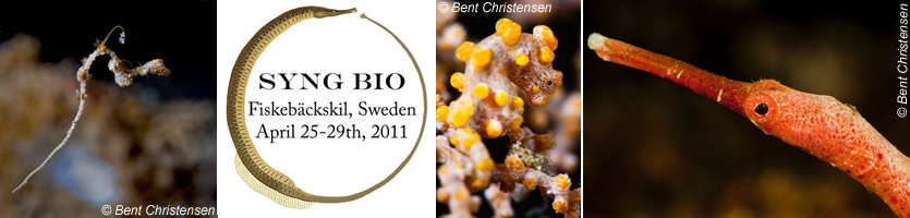
|
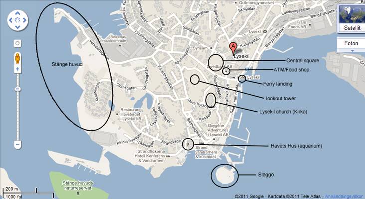
EXCERSIONS Ferry to Lysekil Map of Lysekil |
Fiskebäckskil/Östersidan
The traditional houses of Fiskebäckskil and Östersidan give a sense of timelessness in these
turn-of-the-century fishing villages. Take a short hike up to the windmill,
navigate the cobblestone paths and find the oldest grave in the graveyard of
the fisherman’s church. The two main places to eat, the Brygghuset
and the Gullmarstrand hotel are not open this
afternoon. You can take a short walk over to sleepy Östersidan
and visit Uppsala’s marine station Klubban. On the
road between the two towns are a few pizza cafes and Skäftöhallen,
the local supermarket. Map of skaftö
Stokevik/Grundsund
Grundsund is a quaint old fishing village similar to Fiskebäckskil but on the southern end of Skäftö. You can take bus 845 in the direction toward Grundsund (closest bus stop is by the old church in Fiskebäckskil). There are some small shops and cafes but
nothing fancy. There also is a well marked hiking trail originating from the
upper fields on Kristinebergsvägen that lead all the
way to Grundsund. It’s a gentle loose-gravel path
that winds its way through the small village Stokevik,
past a cholera graveyard and on to Grundsund. The
length of the path to Grundsund is 5km in one
direction so you may want to do only part of it before turning around. If you
brought some running shoes and feel strong, go for it! Map of skaftö
Hiking on Skaftö
There are extensive hiking trails that cover the island of Skaftö.
Some trails are well marked and some are not. The notion of “private property” does
not apply to most of Sweden and you are free to wander anywhere on the island
but stay on paths and roads when in residential areas. There are maps available
on the ferry and postings at trailheads. Some popular spots are Gåsevik, a small secluded bay that can be reached through a
path in the lower fields (turn right by the red barn). Another less accessible
but very nice hike is through the beech forest immediately south of the bridge
to Skaftö. Take bus 845 in the direction of Uddevalla and get off at Lunnevik
immediately before the bridge. There you can follow the signs for röd skogarna. If you follow the
path all the way to the water, there is an old hand-drawn horse ferry. If you
set out on your own, make sure you have some water and snacks and let someone
know where you’re going. Map of skaftö